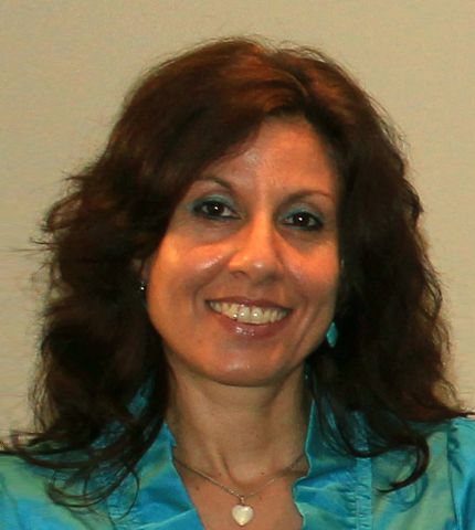
Dr. Margarita Stancheva
Director CCMS
Dr. Margarita Stancheva has more than 22 years` professional experience with special interests in the scope of coastal processes, sand beaches/dunes, coastal erosion, shoreline changes, coastal and maritime tourism, Maritime Spatial Planning (MSP), Land-Sea Interactions (LSI), Multi-Use (MU) concept, Blue Economy, Circular Economy and sustainable coastal development.
Previously she worked as senior research assistant at the Institute of Oceanology – Bulgarian Academy of Sciences (IO-BAS). She holds a Ph.D. in Oceanology in 2009 with thesis: “Beach dynamics and modifications under impact of port and coast-protection structures”. In 2011 – 2013 she coordinated the EU funded SYMNET Project under JOP “Black Sea Basin 2007-2013” (http://www.projectsymnet.eu/). She was coordinator for IO-BAS of the first pilot Black Sea MSP MARSPLAN-BS Project, funded by European Commission, DG MARE (http://www.marsplan.ro). Margarita has been convener of Geomorphology Session at the EGU General Assembly: ”Coastal zone geomorphologic interactions: natural versus human-induced driving factors” since 2009 until present http://www.egu.eu/. She is Research Fellow to the Program for the Study of Developed Shorelines (PSDS), Western Carolina University – USA and in 2013 co-coordinated a joint BG-USA Fulbright project focused on coastal processes and management of the Bulgarian coast (http://www.psds-wcu.org/). Since 2017 Margarita is Secretary of the Commission on Coastal Systems (CCS) to the International Geographic Union (IGU) - http://www.igu-ccs.org/ and Editor of the CCS Newsletter. Author and co-author of more than 50 publications in scientific journals, conference proceedings, books and technical reports. She was CCMS coordinator of the European Commission` DG MARE MARSPLAN-BS II project (2019-2021) to support MSP competent authorities in Bulgaria and Romania in national MSPs. Margarita was involved as a key expert in baseline analysis and policy recommendations for Blue Economy Development Framework for Bulgaria in the context of the Common Maritime Agenda for the Black Sea, developed by the World Bank. Currently she is involved in three large EU projects: 1) Horizon Europe MSP4BIO to align MPA management with MSP process (co-leading WP5 and Black Sea case study, and leading the task on transferability and scale-up of test sites results); 2) EMFAF MSP-GREEN leading CCMS team activities and the Bulgarian case study on valuable MSP practice for integration of EGD in MSP; 3) Horizon Europe Mission BLUE CONNECT, leading WP4 on effective co-ownership and co-management, by involving stakeholders and citizens, and two tasks on the uptake of co-management and co-ownership actions and lessons learnt on monitoring and evaluating conservation effectiveness with replication potential.
Coastal and Marine Knowledge and Research
Coastal and Marine Knowledge and Research
I hold MSc in Applied Geophysics and Oceanology in 1996 from Naval Academy in Varna, Bulgaria and a Ph.D. in Oceanology in 2009 at Institute of Oceanology – Bulgarian Academy of Sciences (IO-BAS). I have ten years of post-doctoral research with strong written and oral communication skills, including peer-reviewed papers and invited talks at many large international events.
Since 1996 I have made research in the scope of coastal and marine geomorphology: modern coastal processes, beach/shoreline changes; cliff erosion/retreat; coastal sand dunes/protected territories; GIS application to shoreline detection and coastline classification; human structures impact; bathymetry mapping, coastal and marine tourism, natural/human-induced coastal hazards and risks; and recently in the field of sustainable coastal development and Marine Spatial Planning (MSP).
During 2003-2007 I wrote a PhD thesis with title: “Beach dynamics and modifications under impact of port and coast-protection structures”, addressing the subject of beach changes and coastal erosion, as well as the ICZM issues in Bulgaria and sustainable coastal development. I am author of a chapter for Bulgaria in a book on “Coastal Erosion and Protection in Europe - A Comprehensive Overview” and co-author in a Coastal Atlas on Sensitivity Mapping and Analysis of the Bulgarian Black Sea Coastal Zone.
During my work as scientist, researcher and expert, since 1996 I have provided knowledge, expertise and project contributions to consider the issues of Integrated Coastal Zone Management (ICZM), Maritime Spatial Planning (MSP), Land-Sea Interactions (LSI), Multi-Use (MU) Concept and Blue economy. These have included:
• Participation at the Advanced International Training Programme “Sustainable Coastal Development, COAST-2005”, organized by Swedish International Development Agency’s (SIDA) during September 12 – October 14, 2005 in Sweden.
• Research in the field of ICZM theme: several scientific papers on ICZM efforts in Bulgaria, few additional peer-reviewed papers addressing the issues of ICZM and coastal erosion in Bulgaria and Black Sea, given numerous oral presentations on the subject of ICZM (for example in 2008 at the 1st PoCoast Seminar on Coastal Research in Porto, Portugal, at the CIESM International Conference on East - West Cooperation in Marine Science, in Sochi, Russia in 2014, at the MEDCOAST Jubilee Workshop in 2015, Dalaman, Turkey, etc.).
Research in the scope of MSP: major contributions under two MSP projects for the Black Sea (Bulgaria and Romania), MARSPLAN-BS I and II (http://www.marsplan.ro/en/).
• Inputs to Detailed analysis of existing conditions of the maritime space for Bulgaria and elaboration of draft MSP plan for Mangalia Shabla cross-border area.
• Land-Sea Interactions: I am the principal author of Burgas Case study: Land-Sea Interactions; and the principal author of the developing methodology for integration of LSI in MSP; and testing the methodology in the cross-border area of Bulgaria, and Best practices and recommendations report on integration of LSI in MSP.
• Multi-Use (MU) Concept and MSP: I am the principal author to the study on MU development of Tourism, UCH and Environmental protection for the cross-border area in Bulgaria.
• Research in the scope of Blue Economy: In 2019-2021 I have been involved as a key expert in developing baseline analysis (diagnostic) and policy recommendations for Blue Economy Development Framework for Bulgaria in the context of the Common Maritime Agenda for Black Sea, coordinated by the World Bank.
Selected relevant publications:
- Stancheva, M., Stanchev, H., Zaucha, J., Ramieri, E., & Roberts, T. (2022). Supporting multi-use of the sea with maritime spatial planning. The case of a multi-use opportunity development-Bulgaria, Black Sea. Marine Policy, 136, 104927. https://doi.org/10.1016/j.marpol.2021.104927
- Mooser, A.; Anfuso, G.; Stanchev, H.; Stancheva, M.; Williams, A.T.; Aucelli, P.P.C. Most Attractive Scenic Sites of the Bulgarian Black Sea Coast: Characterization and Sensitivity to Natural and Human Factors. Land 2022, 11, 70. https://doi.org/10.3390/land11010070
- Stancheva, M., Stanchev, H., Young, R., & Parlichev, G. (2021). Coastal erosion driven Land-Sea Interactions in Maritime Spatial Planning-a case of Bulgaria. Journal of Coastal Conservation, 25(6), 1-19. https://doi.org/10.1007/s11852-021-00841-4
- Stancheva, M., Stanchev, H. 2021. Best practices and recommendations for further work on integrating Land-Sea Interactions into cross-border MSP. MARSPLAN-BS II Project (EASME/EMFF/2018/1.2.1.5/01/SI2.806725), WP2, Activity 2.3, Deliverable 2, 37 p. DOI: 10.13140/RG.2.2.16481.43360
- Stanchev, H., Stancheva, M. 2021. Implementation of LSI-MSP methodology in Shabla Case Study, Bulgaria. MARSPLAN-BS II Project (EASME/EMFF/2018/1.2.1.5/01/SI2.806725), WP2, Activity 2.3, Deliverable 1: Methodology for analysis and integration of LSI in the cross-border MSP, October, 2021, 106 p. DOI: 10.13140/RG.2.2.28225.48483
- Stancheva, M., Stanchev, H. et al. 2021. Methodology for analysis and integration of Land-Sea Interactions in the cross-border MSP. MARSPLAN-BS II Project (EASME/EMFF/2018/1.2.1.5/01/ SI2.806725), WP2, Activity 2.3 Integration of Land-Sea Interactions in Maritime Spatial Planning for the cross-border region, Deliverable 1, October, 2021, 82 p. DOI: 10.13140/RG.2.2.31580.92800
- Stancheva, M., Stanchev, H. 2020. Addressing the Multi-Use Concept with Maritime Spatial Planning in the Cross-Border Region (Bulgaria). MARSPLAN-BS II Project (EASME/EMFF/2018/1.2.1.5/01/S12.806725), Deliverable: WP2, Activity 2.4, June, 2020, 81 pp. http://www.marsplan.ro/en/results/marsplan-bs-ii-addressing-the-multi-use-concept.html.
- Milova, Eolina Petrova; Agostini, Paola; Damianova, Adriana Jordanova; Dotzinska, Adelina Boyanova; Stancheva, Margarita Koleva. 2020. Bulgaria: Toward Blue Economy Development: Toward Blue Economy Development (English). Washington, D.C.: World Bank Group. http://documents.worldbank.org/curated/en/750341608100452940/Toward-Blue-Economy-Development
- Stanchev, H., Stancheva, M., Yong, R., Palazov, A. 2018. Analysis of shoreline changes and cliff retreat to support Marine Spatial Planning in Shabla Municipality, Northeast Bulgaria. Ocean & Coastal Management, Ocean & Coastal Management, Volume 156, 15 April 2018, 127-140, http://dx.doi.org/10.1016/j.ocecoaman.2017.06.011
- Stancheva, M., Stanchev, H., Krastev, A., Palazov, A. & Yankova, M. 2017. Case Study 3 Burgas: Land-Sea Interactions. Report on WP1, Activity 1.1, Component 1.1.2, Cross border maritime spatial planning in the Black sea – Romania and Bulgaria (MARSPLAN–BS Project). June, 2017, 126 p., ISBN: 978-954-9490-49-7.
- Stancheva, M., Stanchev, H. 2017. Sensitivity mapping and assessment of the Bulgarian Black Sea Coastal Zone. In: Kotsev, I., Stanchev, H. (eds.) et al., 2017, Sensitivity Mapping and Analysis of the Bulgarian Black Sea Coastal Zone, Published by Total E&P Bulgaria B.V., ISBN: 978-954-9490-50-3, 146-172.
- Stancheva, M., Stanchev, H., P. Peev, G. Anfuso, Williams, A. T. 2016. Coastal protected areas and historical sites in North Bulgaria - Challenges, mismanagement and future perspectives. Ocean & Coastal Management, 130 (2016) 340-354.
- Stancheva, M., Stanchev, H., Palazov, A., Young, R. 2015. Coastal dune changes under natural/human hazards. 12th International Conference on the Mediterranean Coastal Environment, MEDCOAST 2015 Volume 1, 2015, Pages 385-395.
- Stanchev, H., Stancheva, M. Young, R. 2015. Implications of population and tourism development growth for coastal zone in Bulgaria. Journal of Coastal Conservation, Vol. 19, Issue 1, pp 59-72, DOI: 10.1007/s11852-014-0360-x.
- Stancheva, M., Young, R., Stanchev, H. 2014. Kamchia-Shkorpilovtzi beach, Bulgaria. Published online on Coastal Care, section “Beach of the month” (http://coastalcare.org/2014/05/kamchia-shkorpilovtsi-beach-bulgaria-by-margarita-stancheva-rob-young-hristo-stanchev/).
- Stanchev, H., Young, R., Stancheva, M. 2013. Integrating GIS and high resolution orthophoto images for the development of a geomorphic shoreline classification and risk assessment—a case study of cliff/bluff erosion along the Bulgarian coast. Journal of Coastal Conservation, Vol. 17, p. 719-728. DOI 10.1007/s11852-013-0271-2.
- Stancheva, M. 2013. Bulgaria. In: Coastal Erosion and Protection in Europe - A Comprehensive Overview” – Eds, E. Pranzini, A.T. Wiliams; ISBN-13: 9781849713399 (ISBN-10: 1849713391), 496 pp, Rutledge Taylor & Francis Group.
- Stanica, A., M. Stancheva, G. Ungureanu, V. Peychev, A. Palazov, H. Stanchev, F. Dutu. 2012. Types and Impacts of Maritime Hydraulic Structures on the Romanian - Bulgarian Black Sea Coast - Setting-up a Common Catalogue for GIS-based Coastline Classification. Geo-Eco-Marina Journal, vol. 18, p. 105-118.
- Stancheva, M., Rangel-Buitrago, N., Anfuso, G., Palazov, A., Stanchev, H. and Correa, I. 2011. Expanding level of coastal armouring: case studies from different countries. Journal of Coastal Research, Special Issue 64, 1815-1819, ICS2011, Szczecin, Poland, ISSN 0749-0208.
- Stancheva, M., Ratas U., Orviku K., Palazov A., Rivis R., Kont A., Peychev V., Tõnisson H. and Stanchev H., 2011. Sand dune destruction due to increased human impacts along the Bulgraian Black Sea and Estonian Baltic Sea coasts. Journal of Coastal Research, Special Issue 64, 324-328, ICS2011, Szczecin, Poland, ISSN 0749-0208.
- Stanchev, H. A. Palazov, M. Stancheva. 2010. Bulgarian Black Sea Coastal Atlas (BCA) – current state and future challenges. Proc. of 10th International Conference on Marine Sciences and Technologies “Black Sea’ 2010”, 07-09 October 2010, Varna, Bulgaria. P. 229-234. ISSN 1314-0957.
- Stancheva, M. 2010. Human-Induced Impacts along the Coastal Zone of Bulgaria. A Pressure Boom versus Environment. Compt. Rend. Acad. Bulg. Sci, Volume 63, № 1, 137-146.
- Stancheva, M. 2010. Sand Dunes along the Bulgarian Black Sea Coast. Compt. Rend. Acad. Bulg. Sci, Volume 63, № 7, 1037-1048.
- Stancheva, M. 2009. Indicative GIS-based Segmentation of the Bulgarian Black Sea Coastline for Risk Assessment. Compt. Rend. Acad. Bulg. Sci, Volume 62, № 10, p. 1311-1318.
- Stanchev, H., A. Palazov, M. Stancheva. 2009. 3D GIS Model for Flood Risk Assessment of Varna Bay due to Extreme Sea Level Rise. Journal of Coastal Research, Special Issue 56, p. 1597-1601, ICS2009 (Proceedings) Portugal. ISSN 0749-0258.
- Stancheva, M. J. Marinski, H. Stanchev. 2008. Evaluation of maritime construction impact on the beaches in Varna bay (Bulgarian Coast). Proc. of 9th International Conference on Marine Sciences and Technologies “Black Sea’ 2008”, October 23-25, 2008, Varna, p. 190-195. ISBN 987-954-90156-5-2.
- Stancheva, M., Marinski, J. 2007. Coastal defence activities along the Bulgarian Black Sea coast – methods for protection or degradation? Coastal structures 2007: Proc. of the 5th International Conference, Venice, Italy, 2-4 July 2007; DOI No: 10.1142/9789814282024_0043; pp 480-489.; eds. (L. Franco, G. Tomasicchio & A.)
Project Experience and Outreach Activities
Project Experience and Outreach Activities
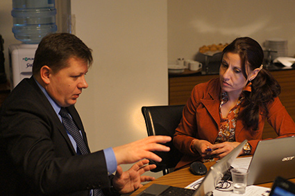
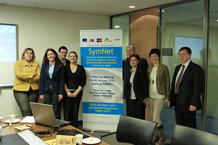
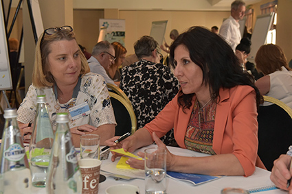
I have extensive experience in coordination and management of successful research and large international projects, such as EU funded SYMNET Project (Industrial Symbiosis Network for Environment Protection and Sustainable Development in Black Sea Basin) under JOP “Black Sea Basin 2007-2013” (http://www.projectsymnet.eu/), two research projects in collaboration with Institute of Ecology, Tallinn University (Estonian Academy of Sciences) and Institute for Marine Geology and Geoecology (GeoEcoMar), Romania, focused on sand dunes preservation and coastline risk classification. Since 2012, I am Research Fellow to the Program for the Study of Developed Shorelines (PSDS), Western Carolina University – USA (http://www.psds-wcu.org/) and in 2013 co-coordinated a joint BG-USA Fulbright project focused on coastal processes and management of the Bulgarian coast.
During 2019-2021 I have been CCMS coordinator of the European Commission`s DG MARE MARSPLAN-BS II Project (Cross border Maritime Spatial Planning for Black Sea – Bulgaria and Romania), Agreement Number: EASME/EMFF/2018/1.2.1.5/01/S12.806725 - MARSPLAN-BS II. During my work I have leaded important project activities on Synthesis report of maritime uses for Bulgaria, integration of Land-Sea Interactions (LSI) into MSP and addressing the Multi-Use (MU) with MSP: this includes a LSI methodology for analysis and integration in MSP, testing the proposed methodology and report on best practices and recommendations for LSI; and elaboration of a pilot case study on MU on Tourism, Underwater Cultural Heritage and Environmental Protection (MPAs) in the cross-border region of Bulgaria (The electronic version of the study is uploaded on the MARSPLAN-BS II project website (http://www.marsplan.ro/en/results/marsplan-bs-ii-addressing-the-multi-use-concept.html) and on the CCMS website: (http://www.ccms.bg/images/gallery/About/OurActivities/art304/ADDRESSING_THE_MULTI-USE_CONCEPT_WITH_MARITIME_SPATIAL_PLANNING_IN_THE_CROSS-BORDER_REGION_BULGARIA.pdf).
In 2019-2021 I was involved in developing baseline analysis (diagnostic) and policy recommendations for Integrated Blue Economy Development Framework for Bulgaria in the context of the Common Maritime Agenda for the Black Sea, coordinated and funded by the World Bank Regional Office, Bulgaria. The objective of the Diagnostic is to inform the vision and strategy for transitioning to Blue Economy in Bulgaria by identifying the challenges and opportunities for shaping a development framework, based on a holistic ecosystem approach to management of coastal and marine resources. It reviews the baseline of the established and emerging Blue economy sectors in Bulgaria that have high potential for sustaining growth and assesses the synergies and potential conflicts between them over coastal and marine resources.The MSP in Bulgaria is pointed as a key tool used to enhance integration of cross-sectoral planning and governance, and stakeholder engagement.
During 2015-2018 I was project coordinator for IO-BAS of the EU MARSPLAN-BS Project (co-funded by DG MARE), the first pilot project for the implementation of the Directive 2014/89/EU for Maritime Spatial Planning in the Black Sea. During my work I have provided a couple of scientific, research and technical contributions to project activities for Bulgaria: elaboration of detailed studies for a complete analysis of the Romanian and Bulgarian marine areas; responsible for case study Burgas land-sea interactions; reviewing the institutional and legislative framework relevant for the Black Sea maritime spatial planning in Romania and Bulgaria; common strategic framework for maritime spatial planning in Romania and Bulgaria; elaboration of a maritime spatial plan for the cross-border area (Mangalia – Shabla); defining the indicators to be monitored and monitoring procedures; elaboration of lessons learned and practical recommendations for improving the MSP process. I was the primary author of the Case Study Burgas: Land-Sea Interactions (published as a book) specifically focused to follow the land-sea interactions and to identify the interactions, conflicts and impacts between uses, sectors and environment both terrestrial and marine using the synergy/conflict land-sea interaction matrix. The electronic version of the study is uploaded on the website of the European MSP Platform (http://msp-platform.eu/practices/case-study-burgas-land-sea-interactions).
In 2014 I was involved as an expert to the Intersessional Working Group (IOC-UNESCO) for review and improvement of the Global Ocean Science Report (GOSR).
Since 2009 until now I have been convener and chair of a Geomorphology Session at the European Geoscience Union General Assembly: ”Coastal zone geomorphologic interactions: natural versus human-induced driving factors” (http://www.egu.eu/).
Since 2017 I have taken the role of Secretary of the Commission on Coastal Systems (CCS) to the International Geographic Union (IGU) - http://www.igu-ccs.org/ and Editor of the CCS Newsletter. The focus of CCS attention is on interactive systems, both human and physical, and the areas of inquiry include issues such as sea-level rise, land-use changes, estuarine resources, coastal tourism and shoreline development, coastal recreation, and coastal zone management.
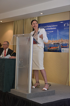
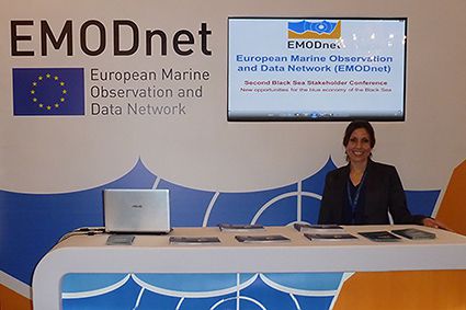
Selected relevant publications and projects:
- Stancheva, M., Stanchev, H. 2020. Addressing the Multi-Use Concept with Maritime Spatial Planning in the Cross-Border Region (Bulgaria). MARSPLAN-BS II Project (EASME/EMFF/2018/1.2.1.5/01/S12.806725), Deliverable: WP2, Activity 2.4, June, 2020, 81 pp. http://www.marsplan.ro/en/results/marsplan-bs-ii-addressing-the-multi-use-concept.html.
- Milova, Eolina Petrova; Agostini, Paola; Damianova, Adriana Jordanova; Dotzinska, Adelina Boyanova; Stancheva, Margarita Koleva. 2020. Bulgaria: Toward Blue Economy Development (English). Washington, D.C.: World Bank Group. http://documents.worldbank.org/curated/en/750341608100452940/Toward-Blue-Economy-Development.
- Stanchev, H., Stancheva, M., Yong, R., Palazov, A. 2017. Analysis of shoreline changes and cliff retreat to support Marine Spatial Planning in Shabla Municipality, Northeast Bulgaria. Ocean & Coastal Management, Volume 156, 15 April 2018, Pages 127-140, http://dx.doi.org/10.1016/j.ocecoaman.2017.06.011.
- Stancheva, M., Stanchev, H., Krastev, A., Palazov, A. & Yankova, M. 2017. Case Study 3 Burgas: Land-Sea Interactions. Report on WP1, Activity 1.1, Component 1.1.2, Cross border maritime spatial planning in the Black sea – Romania and Bulgaria (MARSPLAN–BS) Project. June, 2017, 126 p., ISBN: 978-954-9490-49-7.
- MARSPLAN-BS II Project (Cross border Maritime Spatial Planning for Black Sea – Bulgaria and Romania), Agreement Number: EASME/EMFF/2018/1.2.1.5/01/S12.806725 - MARSPLAN-BS II (2019-2021).
- MARSPLAN-BS Project (Cross-Border Marine Spatial Plan for the Black Sea – Romania, Bulgaria), Grant Agreement no EASME/EMFF/2014/1.2.1.5/2/SI2.707672 MSP LOT1 Black Sea/ MARSPLAN BS (2015-2018) - http://www.marsplan.ro/.
- SYMNET Project (Industrial Symbiosis Network for Environment Protection and Sustainable Development in Black Sea Basin), Contract number: 1.1.3.65910.92 – MIS-ETC 287, funded by the European Union under the Joint Operational Programme “Black Sea Basin 2007-2013” (2011-2013) - www.projectsymnet.eu.
- Coastal processes and sustainable development of the Bulgarian coast. Joint Research Project Fulbright Program 2012/ 2013 – Prof. Robert Young, Programme for the Study of Developed Shorelines (PSDS), Western Caroline University, USA (http://www.psds-wcu.org/).
- Coastal sand dunes along the Estonian and Bulgarian Black Sea shorelines: inventory and natural/human-induced changes - joint research project between Bulgarian Academy of Sciences and Estonian Academy of Sciences (2010-2012).
- Joint GIS-based coastal classification of the Bulgarian-Romanian Black Sea shoreline for risk assessment. Joint research project between Bulgaria and Romania, (Institute of Oceanology - BAS and National Research and Development Institute for Marine Geology and Geoecology), National Science Fund, (2010-2012), Grant Nо: DNTS 02/11.
- Sea basin checkpoint LOT NO: 4 – Black Sea, EC DG MARE, EMFF/2014/1.3.1.3 - MARE/2014/09 – Lot 4 (http://emodnet-blacksea.eu/).
- “Preparation of an Environmental Sensitivity Map (ESM) focusing on the Bulgarian sectors of the Black Sea in connection with TOTAL E&P Bulgaria B.V. exploration operations”. Contract Ref. No TEPBG – XA-010. FRAMEWORK CONSULTANCY AGREEMENT – Provision for Environmental Consultancy Services.
- HERAS Project (Submarine Archaeological Heritage of the Western Black Sea Shelf) 2 (4i)-3.1-26 MIS ETC Code: 578 under the CBC Programme Romania - Bulgaria 2007-2013, Contract № 64727/09.08.2013, (2013-2015).
- Comparison of coastal processes and monitoring activities between some Bulgarian and Spanish beaches – joint research project between Bulgarian Academy of Sciences and Spanish Academy of Sciences (CSIC), (2006-2008).
- ARCADIS Euroconsult Project “Support to the Black Sea Basin Directorate for the implementation of the Water Framework Directive concerning coastal water monitoring in Bulgaria (WFD Directive 2000/60/EC of the European Parliament and of the Council), (2006).
Field Work
Field Work
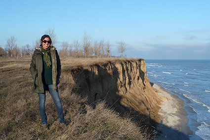
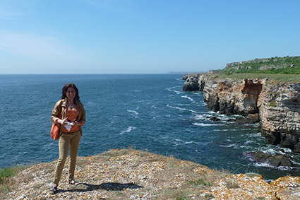
I have extensive experience in marine and coastal data processing and analysis, as main author or in a team, which includes:
- Shoreline/cliff mapping, coastline classification (identifying natural and human landforms) and processing of data from different sources: large and small topographical maps, nautical maps, geological maps, high resolution ortophoto and satellite images.
- Environmental Sensitivity Mapping (ESM) of the Bulgarian Black Sea coastal zone under a contract with TOTAL E&P Bulgaria B.V. oil and gas exploration operations. The mapping of the sensitivity of the environment to accidental oil pollution is an essential step in oil pollution preparedness, response and co-operation efforts, and maps are a crucial tool to assist responders during an incident. The produced ESM is consistent with protocols outlined in the International Petroleum Industry Environmental Conservation Association/International Maritime Organization (IPIECA/IMO) document “Sensitivity Mapping for Oil Spill Response” (IPIECA 2011).
- Experience in ArcGIS Digital Shoreline Analysis System (DSAS). The software computes the rate of shoreline change using historical shoreline positions represented in a GIS. The software can also be used to compute rates of change for other boundary change issues that incorporate a clearly identified feature position at discrete times, analyze shoreline change using a GIS, calculate rate-of-change statistics from multiple shoreline positions etc.
- Work as expert in EMODNET Black Sea checkpoint, WP Bathymetry. I worked in a team to produce the Black Sea and Azov Sea coastlines by digitalization of 14.25 m panchromatic LandSat 7 ETM+ satellite images, and a contour bathymetry map for the Black Sea Basin with intervals of 100 meters. Another work was to identify and indicate priority areas for safer navigation taking into account emerging needs and map of uncertainty in water depth for the Black Sea Basin.
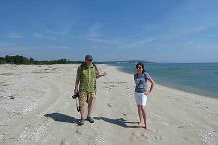
- Field experience in:
- Aerial photo survey of the Bulgarian Black Sea coast
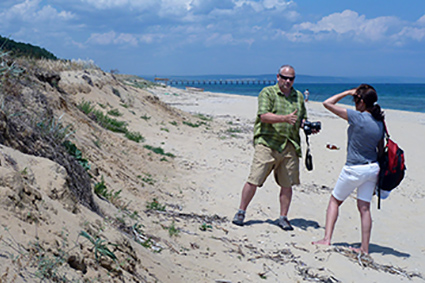
- Monitoring of sand beaches and dunes
- Monitoring of coastal/ cliff erosion
- In-situ measurements of coastal erosion rate
- Ship cruises - experience in sediment bottom sampling
Relevant publications and projects:
- Stanchev, H., Stancheva, M., Yong, R., Palazov, A. 2017. Analysis of shoreline changes and cliff retreat to support Marine Spatial Planning in Shabla Municipality, Northeast Bulgaria. Ocean & Coastal Management, Volume 156, 15 April 2018, Pages 127-140, http://dx.doi.org/10.1016/j.ocecoaman.2017.06.011.
- Stancheva, M., Stanchev, H. 2017. Sensitivity mapping and assessment of the Bulgarian Black Sea Coastal Zone. In: Kotsev, I., Stanchev, H. (eds.) et al., 2017, Sensitivity Mapping and Analysis of the Bulgarian Black Sea Coastal Zone, Published by Total E&P Bulgaria B.V., ISBN: 978-954-9490-50-3, 146-172.
- Stanchev, H., Young, R., Stancheva, M. 2013. Integrating GIS and high resolution orthophoto images for the development of a geomorphic shoreline classification and risk assessment—a case study of cliff/bluff erosion along the Bulgarian coast. Journal of Coastal Conservation, Vol. 17, p. 719-728. DOI 10.1007/s11852-013-0271-2.
- Stancheva, M. 2009. Indicative GIS-based Segmentation of the Bulgarian Black Sea Coastline for Risk Assessment. Compt. Rend. Acad. Bulg. Sci, Volume 62, № 10, p. 1311-1318.
- “Preparation of an Environmental Sensitivity Map (ESM) focusing on the Bulgarian sectors of the Black Sea in connection with TOTAL E&P Bulgaria B.V. exploration operations”. Contract Ref. No TEPBG – XA-010. FRAMEWORK CONSULTANCY AGREEMENT – Provision for Environmental Consultancy Services.
- Coastal processes and sustainable development of the Bulgarian coast. Joint Research Project Fulbright Program 2012/ 2013 – Prof. Robert Young, Programme for the Study of Developed Shorelines (PSDS), Western Caroline University, USA (http://www.psds-wcu.org/).
- Coastal sand dunes along the Estonian and Bulgarian Black Sea shorelines: inventory and natural/human-induced changes - joint research project between Bulgarian Academy of Sciences and Estonian Academy of Sciences (2010-2012).
- Joint GIS-based coastal classification of the Bulgarian-Romanian Black Sea shoreline for risk assessment. Joint research project between Bulgaria and Romania, (Institute of Oceanology - BAS and National Institute for Marine Geology and Geoecology), National Science Fund, (2010-2012), Grant Nо: DNTS 02/11

