The 34th International Geographical Congress was held 16-20 August 2021, convened by Istanbul University, Turkey. In view of the continuing disruption due to Covid19, this was a virtual Congress. More than 600 delegates from 75 countries were part of the event.
The First International Geographical Congress was held in Antwerp in 1871, and it passed a motion in favour of the use of the Greenwich Meridian as a global standard. And 150 years later, IGC remains the greatest periodic international event for the world geographic community; the various plenary presentations and parallel sessions were scheduled according to GMT.
The Commission on Coastal Systems (CCS) to the International Geographical Union (IGU) (http://igu-coast.org/) convened three parallel sessions at the Congress, chaired by Margarita Stancheva (CCS Secretary) and Colin Woodroffe (CCS Chair), and focused on the theme ‘sustaining coastal and marine environments in the Anthropocene’.
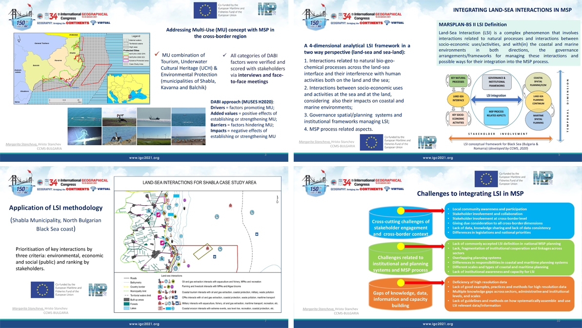
In the context of the MARSPLAN-BS II project, (funded by the EMFF via the European Commission` DG MARE and CINEA) as partner in the project, CCMS leads two important activities on addressing the Multi-Use (MU) Concept with MSP and integration of Land-Sea Interactions (LSI) in MSP. In her presentation, Dr. Margarita Stancheva (CCMS project coordinator) presented the results of elaborated MU case study in Bulgarian maritime space: exploring the potential for development of one MU combination: Tourism, Underwater Cultural Heritage (UCH) & Environmental Protection (municipalities of Shabla, Kavarna and Balchik) and the identified key drivers and barriers, as well as key recommendations to overcome these barriers.

Dr. Stancheva addressed also the LSI issues at the land-sea interface, incorporating both natural processes and the impact of human activities, as well as institutional frameworks as part of maritime spatial planning in the Black Sea (Bulgaria and Romania). She presented the developed by CCMS methodology for LSI analysis and their integration in MSP, results from testing the methodology in the cross-border region of Bulgaria (Shabla Municipality), specific study on coastal erosion, identified challenges for integrating LSI and enabling factors for including LSI in MSP that have been identified in the Bulgarian case study for application of methodology for LSI analysis and during the overall project works.
For more details and complete presentation follow the MARSPLAN-BS II project website.
