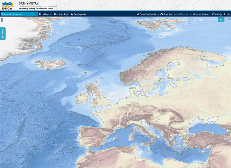
An upgraded version of the EMODnet Bathymetry Digital Terrain Model (DTM) for the European Seas has just been released. This bathymetry product now offers higher resolution, powerful 3D visualisation functionality and extended coverage of Europe’s seas. It is available free of charge for viewing and downloading, and sharing by OGC web services from the EMODnet Bathymetry portal.
The EMODnet DTM is a tool used for a whole range of applications in marine science, sustainable ocean governance, and blue economy activities such as planning of pipeline trajectories, locations of offshore wind farms or planning of harbour extensions. In science, the DTM supports oceanographers in providing a base geometry for hydrodynamic models, marine geologists for studying morphological processes, and biologists in contributing to the generation of seabed habitat maps. An improved DTM also contributes to reducing risks for damage to coastal and offshore installations and public safety by improving our ability to forecast storm surges, for example.
The advanced EMODnet DTM offers many benefits to users:
• A resolution increased from 1/8*1/8 arc minutes to 1/16*1/16 arc minutes (circa 115*115 meters). Altogether the EMODnet DTM contains 113892 x 108132 = circa 12.3 billion data points;
• A powerful 3D visualisation functionality of the bathymetry that can be used in the browser without the requirement of plugins;
• A faster representation of the complexity of the map;
• An expanded coverage including all European seas as well as the European part of the Arctic Ocean and Barents Sea;
• An increased number of bathymetric survey data sets and composite DTMs from 48 data providers used as data sources from circa 7.200 to circa 9.400 for which metadata can be retrieved through a source reference layer;
• The number of bathymetric survey data sets and composite DTMs, used as data sources, has increased from about 7.200 to about 9.400. These come from 48 data providers. All related metadata can be retrieved through a source reference layer;
• The inclusion of Satellite Derived Bathymetry data products, in particular for coastal stretches of Spain and Greece.
The EMODnet DTM allows users to activate and view bathymetry layers as well as contours and underwater features for the selected areas. Among other functionalities, it is possible to zoom in/out, to switch on/off several layers, as well as to browse data and look up metadata about the underlying data source. Users can draw transects and retrieve the associated bathymetric profiles.